John Muir Trail Adventure Journal: Day 12
Center Basin to Timberline Lake (just past)
Approximately 19.6 miles. Cumulative: 200.6 miles.
I woke up in the middle of the night with my ankle on fire. Not literally, of course, but it has swelled even more and was rebelling against the elastic. Bandage. I peeled it off the elastic bandage for relief.
I slept a little later than normal. The couple from La Crescenta were still sleeping, so I tried to break camp as quietly as possible. I hope I didn’t disturb them too much.
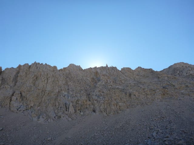
I got moving on the trail at 7:20. I was only a few miles from Forester Pass, the last and tallest pass on the John Muir Trail (unless you count Trail Crest), and it wasn’t long before I walked past the last serious tree cover.
I had 2,000 feet of elevation to climb to Forester Pass. It seemed to go on forever, certainly a lot longer than the 4.4 miles advertised. But at least it felt more gradual than some of the other passes.
Initially the weather was pleasantly cool, but once the sun rose over the mountains, it warmed up. Now this wasn’t just something that happened that day — it happened every day. Because you’re up so high, it can be daylight for quite some time before the sun comes up over the surrounding peaks. I found that once the sun did come up, though, it got warm rather quickly (of course this works in reverse in the evenings).
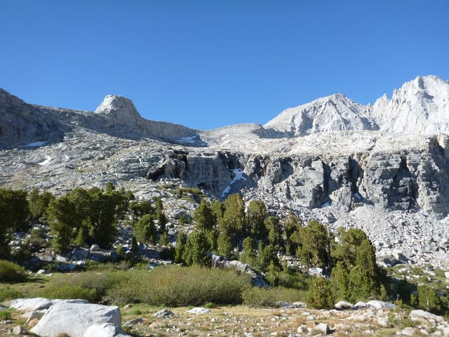
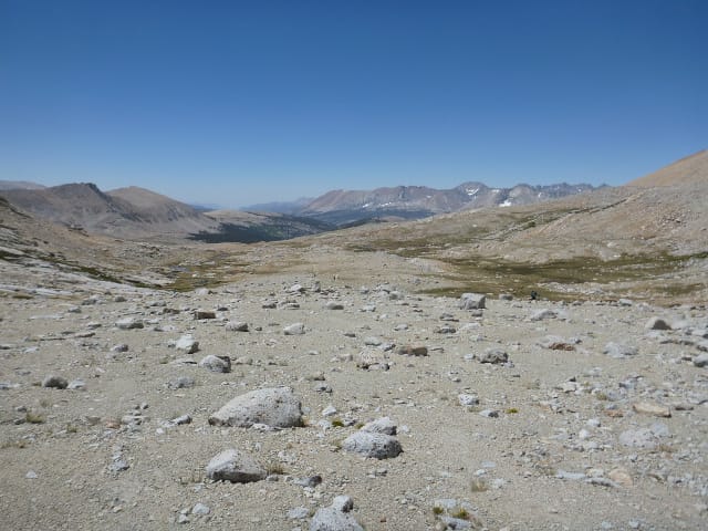
On this approach, that effect was particularly noticeable, maybe because there were no sheltering trees to provide shady relief. It was just bare rock. Interesting geologic formations, to be sure, but bare rock nonetheless.
Food stopped having significant meaning. I don’t mean eating it — I was still plenty hungry — I just didn’t care what I ate or when I ate it. For instance, lunch foods looked better for breakfast than breakfast foods. I also sucked down a few packets of GU Roctane as I limped along. That really helped power me along.
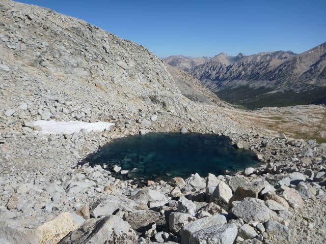
The climb dragged on. In places when I stopped to rest, I could hear water running underneath the rocks, which was really fascinating. I came to a little alpine lake, and I thought I was almost there, but the trail kept on going up. I realized then that this was not the lake I was looking for, though it was very beautiful.
The trail switchbacked a few times. I wasn’t entirely sure where the pass was from where I was standing. I’d be interested to climb this when i was more rested. I think my sore ankle and general weariness were slowing me down.
Eventually, I reached the lake at 12,250 feet. At least that’s what the book calls it. If it has another name, I don’t know what it is. I wish I could say the pass is right after this lake, but I still had more climbing to do.
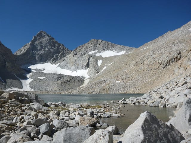
After a few more switchbacks, I came to a snowfield, relatively flat, about 60 feet long. Another hiker was coming across from the other direction. She seemed very worried about the snow, more worried that this section of snow called for. She got down on all fours and crawled across it. It took her a long time, and she complained, loudly, the entire time. I thought it strange that someone so fearful of this situation would choose to hike in the Sierras in June. Normally, there is much more snow along the trails through the passes.
Now, sure, slipping is a very valid concern, but this seemed like an extreme response. I hoped she didn’t get too freaked out at Glen Pass. The snowfield there had been significantly steeper.
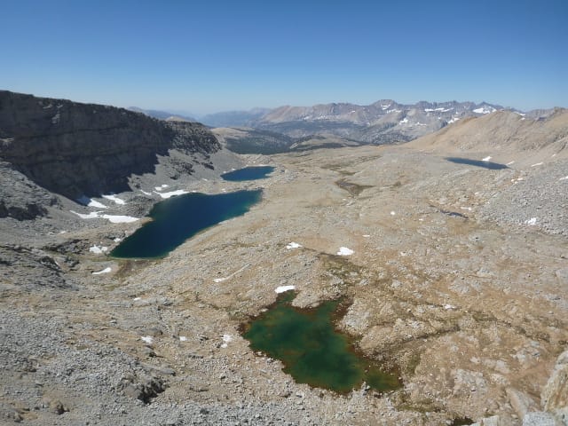
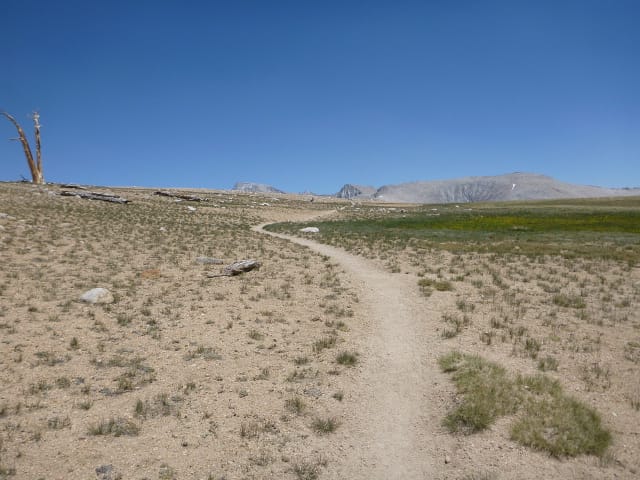
Then, after having a great conversation with a hiker, I was over the pass and looking down at a broad basin with a few lakes.
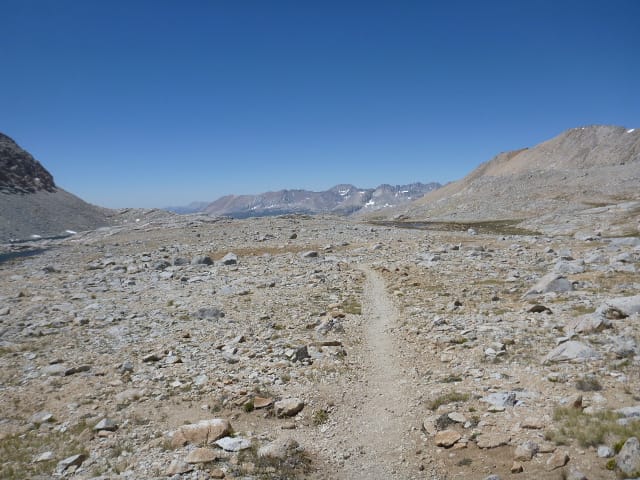
Going down was still harder than going up on my swollen ankle, so the descent took some time, and when I got to the bottom, I saw the trail that stretched out for as far as I could see. It was surreal.
As I hiked, I could see the north-bound hikers lined up like so many planes coming in to land at an airport.I kept on the lookout for any rocks that looked good for sitting, occasionally taking advantage of these, and enjoying the conversations with the north-bound hikers. I had a lot of information they wanted, and I was happy I could help them out.
Eventually, I reached Tyndall Creek. I filled up with water and had a snack, then started a really long walk to find a campsite. I made my way up to and across Bighorn Plateau, which was pretty cool, but fairly surreal. It was also the first glimpse of Mt. Whitney in the distance.
At Wright Creek, I ran into a group of about five really stoned hikers. Some of them were in their underwear. They quickly pointed out to me that it was Hike Naked Day. I didn’t know there was a thing, and I’m glad they weren’t totally naked, but I’m glad they told me about it. I realized then that I had no idea what had happened for the past week, and even then, the news was sporadic at best. The world could have been overrun by zombies and I wouldn’t have known.
By the time I got to Crabtree Meadow, I was a hurting unit, so I didn’t go down to ranger station to get my required wag bag. I’d heard reports that there were no bags there, and I didn’t look forward to hiking down the hill for no good reason. I was entering Whitney Zone, and regulations stated I needed one if I had to do any business (no cat holes allowed here). I was a little nervous, because, well, the timing was right that I just might need it. But if it came to that, I’d hold it and hike faster.
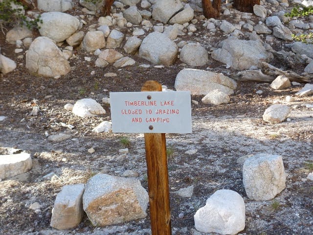
In looking at the map, my general plan was to camp at Timberline Lake. It was the last lake before Guitar Lake and the climb up to Trail Crest. But when I got to Timberline Lake, I saw this sign.
I just wanted to stop. Dejected, I sat down on a rock and leaned back a bit to take the weight off my shoulders. I must have looked as miserable as I felt, because a group of hikers passing by told me not to worry, there was a good site another half-mile or so down the trail.
I reluctantly got shuffled my way along, eventually finding the site they’d mentioned. It did look pretty nice.
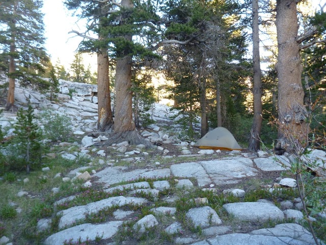
This would be my last campsite on this adventure, and I was happy to finally be able to crawl into the sleeping bag. I was really looking forward to finishing, but I was blissfully ignorant of how challenging the climb to Trail Crest would be.