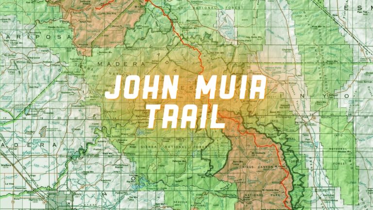
John Muir Trail Adventure Journal: Day Four
Trinity Lakes to Deer Creek Crossing
Approximately 11.7 miles. Cumulative: 64.7 miles.
I had a restless night. This was the only night on the trail that I didn’t sleep soundly. Instead, I felt feverish all night, but by morning I felt decent enough to crawl out of my sleeping bag and keep going. Not that I had much of a choice.
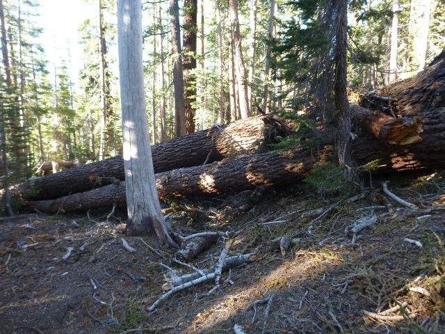
I only had about 3.5 miles to go to Devil’s Postpile, but the going was strenuous and slow because of the large number of downed trees. I had many logs to climb over, go around, or go through. In some places the trail had been obliterated. This is why people advised taking the PCT instead.
A bit about these blowdowns.
On November 30, 2011 the Devil’s Windstorm (the devil is a frequently invoked entity in the forest, it seems) tore through the Mammoth and Mono Lake areas, with the worst damage right here where I was (typically called the Red’s Meadow region for reasons to come in a moment). They say more than 400,000 trees were brought down by the 180 mile-per-hour winds. The effects of the storm were felt as far south as Pasadena (and possibly further). The Forest Service and its volunteers did an admirable job cleaning it all up. You can read the report of the whole affair for yourself.
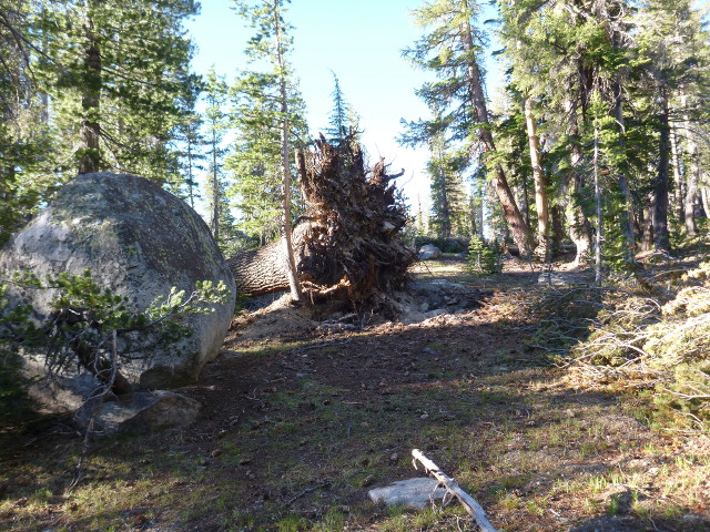
In short, it was a mess and a challenge to traverse. But as rough as it was that morning, there were spots ahead that would prove to be more challenging.
Oh, and at some point in between crawling over logs, I had to use the bathroom again. It still wasn’t fun.
I was almost to Devil’s Postpile, looking forward to a little rest, when a patch of loose sand shifted under me and I tumbled down a steep slope.
I broke a pole …

… and banged up my elbow pretty good.
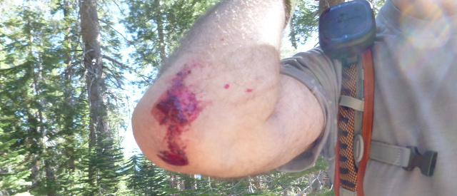
And on top of all that, I realized I lost a sock. And there was no way I was going back for it.
As I crossed a bridge into the heart of the monument, I ran into a day hiker from the nearby campsite. He was the first person I’d seen in about 24 hours. It had been a strange kind of solitude that I didn’t even think about until I saw this guy, and the last time I’d experience this kind of solitude on the trail.
In addition to the campsite, which was about half a mile down a side trail (the whole area is a network of intersecting trails), my map indicated there was a ranger station. While this was in the opposite direction I was ultimately heading, I was hungry, cranky, and a little bloody, so I headed off that way to eat, rest, and tend my wounds.
I dropped my gear at a picnic table and boiled some water from a fountain. It was always a bonus when I didn’t have to use my treated supply. As I was off getting the water, a Stellar’s Jay ravaged a small bag of trail mix that was in my pack’s hip belt pocket.
A bit about birds.
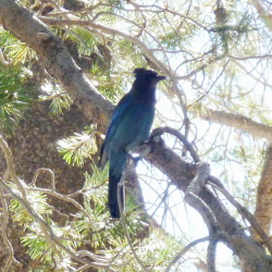
When I was a kid I often read the Peterson’s Field Guides to Eastern Birds and Western Birds. A lot. I was always amazed and a little jealous at all the fabulous birds that lived on the west coast. I couldn’t wait to see many of them, including the Steller’s Jay. I found them much more interesting than the boring old Blue Jays I grew up with, which always seemed like the dicks of the bird world. But now that I’ve seen a Steller’s Jay up close and personal, I can safely say they’re dicks, too.
So, now bandaged up and fed, I decided to take a look at this Devil’s Postpile.
Unless you’re a crazy rock formation aficionado, I can’t say I’d recommend making the trip to this place just to see these crazy rock formations (it’s 13 miles from Mammoth Lakes, and you have to take the mandatory shuttle bus during the busy season), but if you happen to be in the greater Mammoth Lakes area, then it’s worth a trip.
The Postpile consists of naturally occurring pentagonal- and hexagonal- shaped columns of basalt rising 60 feet straight up into the air, formed from lava flows more than 100,000 years ago. Pretty amazing.
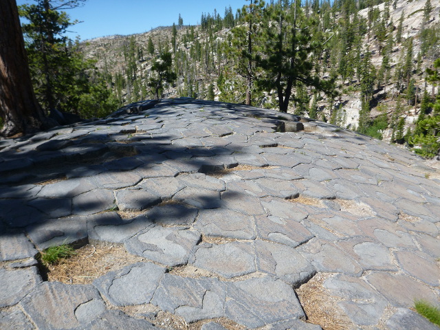
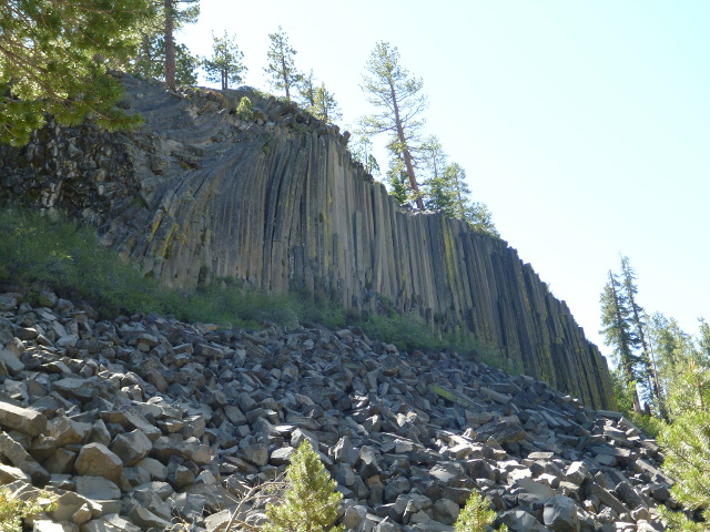
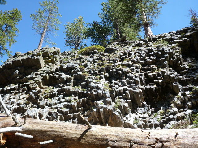
After I walked through the monument, I saw a sign for the John Muir Trail and continued on my way, a little annoyed at having lost time licking my wounds, but overall happy to be on my way. Until I came to a trail crossing for King Creek. That wasn’t right, and I realized I had no idea where I was.
I panicked a little and pored over the map. I was just about to dig out the compass when I realized my mistake. I’d taken the JMT the wrong way and was headed back north. That meant if I kept going on this path, it would take me back to the entrance of the Devil’s Postpile monument, not too far from where I’d fallen. And that’s exactly what happened. After a little more walking, I saw the distinctive basalt columns on the other side of the San Joaquin River, the same columns I’d walked by hours earlier. Shortly after that, I started a walk back through the Devil’s Postpile. So after I’d wasted something like three hours and walked an extra four or so miles. I was back on track.
But I was beat, mentally and physically, so when I when got to the next trail junction (Rainbow Falls trailhead) I took it. There was was a (locked) toilet and a water fountain of dubious quality. I didn’t drink from the fountain but sat and had lunch. Turns out I had a cell signal. I needed a friendly voice, so I called the wife. A small part of me was ready to quit this ridiculous venture right then and there, but after I venting a little to someone I trusted, I felt slightly better.
This area I was in led to Red’s Meadow Resort, one of the re-supply stops along the JMT and PCT. It’s renowned for its hot springs-powered hot tub and bathhouse. The food is supposedly good, too. I didn’t send a re-supply to them (I had one waiting for me a few days later), but if I were to do this again, I would take advantage of all the re-supply points I could. But it didn’t matter this time, as the place was closed due to the blowdowns.
There was a crew of three guys there, cleaning up the mess from the blowdowns. They told me that they heard Red’s Meadow wouldn’t open until at least June 17 (four days hence), which was good information to have. It didn’t do me any good, but I knew north-bound PCT hikers I’d run into would appreciate the information.
Tip: There’s an easy entrance to Red’s Meadow right off the JMT a short distance after the trail intersection. There’s a sign and everything. A thinking man would have taken a picture, but I wasn’t thinking too well at that moment.
Right after you pass this sign, you walk into an area nearly devoid of trees. Instead, it’s mostly charred stumps as far as you can see, the aftermath of the Rainbow Fire which burned thorough this area in 1992 (just to spell it out, that was 20 years prior).
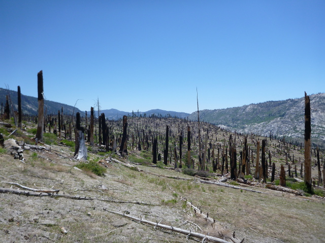
This section was hot and dry. This was the first time I almost ran out of water, but I found a few different streams. I met a good number of PCT hikers during this stretch, and they all asked about Red’s Meadow. It wasn’t good news for them; it meant that if they wanted to experience civilization, they’d have to hike out to Mammoth Lakes via Mammoth Pass and Horseshoe Lakes, something like four uphill miles. And a few of them had some of the biggest packs I’d seen so far, and those hikers looked pretty miserable. I was glad for my compact 30-pound backpack.
Eventually I got to Deer Creek crossing and decided to stop. The next “guaranteed” water wasn’t until Duck Lake, another 5 or so miles down the trail, and I was tired. There were a couple of nice campsites right off the trail, so I grabbed one. It was a little earlier than I usually stopped hiking, but I felt I deserved a bit of a break.
Shortly after I got there, the gent who gave me the tip about a better way to carry the bear canister rolled up and snagged one of the other campsites. His name Tyler. We spent the night chatting about gear, food, and the prospect of getting to Vermilion Valley resort on the 15th. it was nice having a someone to talk to.
As we cooked up our respective dinners, a gent hiking the PCT wandered down the trail. He stopped at the creek, filled up his water bottle and drank it straight from the steam. A bold move to be sure.
A little about water.
The serious PCT hikers I met had a tendency to carry only one water bottle I carried two), usually a 500 ml Gatorade or Smart Water bottle, and would drink every time they came across a water source, refilling their bottle each time. It was rare if they filtered their water, claiming it wasn’t necessary this early in the season.
Maybe not, but i treated every drop I drank. Better safe than sorry, especially when it comes to gastrointestinal distress. My preferred method was Aqua Mira, a two-part solution that, when combined, created s highly oxidized solution that killed all pathogens, including the dreaded cryptosporidium and all viruses.
I’d also filter with the MSR Hyperflow, which was useful for filtering cloudy and/or muddy water. It didn’t filter viruses, though, and using it took some effort and time. I didn’t use it very often, preferring the relative speed and ease of Aqua Mira. It was nice to know I had it though.
REI has a nice article on the risks one faces with drinking water in the backcountry if you want to know more.
One of the sources I’d gotten water from earlier in the day was one of the naturally occurring soda springs in the area. I was a bit surprised when I first took a sip. I didn’t expect to taste carbonated water and my first instinct was to spit it out. Then I realized what it was; I’d read a bit about the soda springs and john Muir’s fondness of them. I was pleased and saved that bottle for the next day.
Anyway, the night was the usual routine: eating, cleaning, previewing the trail for the next day’s adventure, and getting to sleep. rest was welcome, and I slept well.
